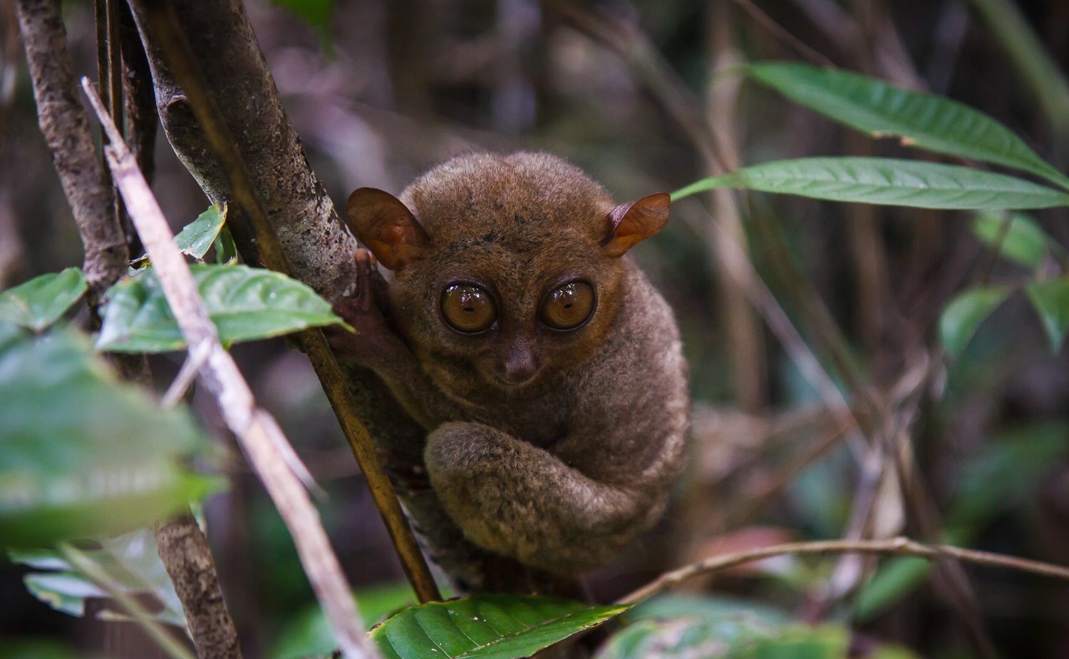
Philippine Tarsier Sanctuary
45 min drive
Located in Corella, this sanctuary provides a controlled environment to observe the Philippine Tarsier in its natural habitat.
The Bohol countryside tour follows a clockwise or counter-clockwise loop from Tagbilaran City, covering eight to ten attractions across 85 kilometers. Most operators anchor the circuit around the Chocolate Hills Complex in Carmen, then radiate outward to the Tarsier Sanctuary, Loboc River, Baclayon Church, and the Blood Compact Shrine. Understanding the route sequence and distances between stops lets you estimate drive time, negotiate with drivers, or self-navigate if you rent a vehicle.
Quick answer
A bohol countryside tour map traces a roughly circular route from Tagbilaran City northeast to Carmen (Chocolate Hills), south through Loboc and Loay, then west back to the capital. Total loop distance is 80-90 kilometers depending on which stops you include. The standard itinerary visits the Tarsier Sanctuary (12 km from Tagbilaran), Chocolate Hills Complex (55 km), Loboc River lunch cruise (65 km), Baclayon Church (75 km), and Blood Compact monument (6 km from Tagbilaran), covering the circuit in seven to nine hours including meal and photo stops.
The countryside tour circuit predates digital mapping by decades—drivers committed the route to memory long before GPS units reached provincial roads. Today's bohol countryside tour map digitizes that collective knowledge into a navigable loop, but the sequence remains unchanged: northeast from Tagbilaran to the karst highlands, then a southward descent through river valleys and coastal plains. The route's geometry is dictated by topography, not convenience, and that explains why most operators follow the same clockwise flow rather than innovating shortcuts. The Chocolate Hills Complex sits at the route's geographic and narrative apex, 55 kilometers from the capital and 222 steps above the surrounding plateau. Tour vans depart Tagbilaran between 8:00 and 9:00 to reach Carmen by mid-morning, when mist still clings to the conical hills and the observation deck is not yet crowded. From the complex, the route drops south through Bilar's mahogany forest—a 25-kilometer ribbon of man-made canopy—then forks toward Loboc for the river cruise or continues to the Tarsier Sanctuary near Corella. Both branches converge at Baclayon, where the 1727 stone church anchors the tour's historical component. The final leg west to Tagbilaran passes the Blood Compact Shrine in Bool, a five-minute stop that most itineraries append as a formality rather than a destination. Distances between major stops range from ten to twenty kilometers, but provincial road conditions and frequent stops inflate drive time. The segment from Tagbilaran to Carmen alone requires 75 to 90 minutes, and the Loboc River cruise adds a fixed 60-minute float to any itinerary that includes it. Self-drivers gain schedule flexibility but sacrifice the local route knowledge that prevents wrong turns at unmarked junctions near Bilar and Loay. Motorbike rentals are common among solo travelers, though the 150 PHP conservation fee at the Chocolate Hills Complex and separate entrance fees at the Tarsier Sanctuary and Baclayon Church apply regardless of transport mode. Van charters for four to six passengers cost 2,500 to 3,500 PHP for the full loop, fuel and driver included, making shared rides the default for most visitors arriving without their own vehicle. The Bohol countryside tour route functions as both a geographic circuit and a narrative scaffolding, linking ecological landmarks in the highlands with colonial-era architecture along the coast. No single attraction defines the tour; the map itself is the product, and its value lies in the sequencing rather than any individual stop.
“The route's geometry is dictated by topography, not convenience, and that explains why most operators follow the same clockwise flow rather than innovating shortcuts.”
This sequence suits visitors joining a guided countryside tour or self-driving with an early start. The route covers Bohol's interior highlights in 6–7 hours, following a clockwise loop that minimizes backtracking.
Brief photo stop at the historical marker commemorating the 1565 treaty between Sikatuna and Legazpi. Most tours spend 10–15 minutes here before continuing inland.
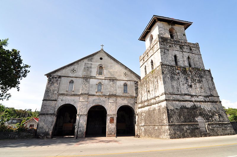
Explore one of the Philippines' oldest stone churches, partially restored after the 2013 earthquake. The attached museum requires a separate fee; allow 30 minutes total.
Board a floating restaurant for a buffet lunch while drifting past jungle banks and a cultural performance. Cruises last 60–90 minutes and depart when full.
Walk the boardwalk loop to observe nocturnal tarsiers resting in daylight. Keep voices low and cameras flash-free; the visit takes 20–30 minutes.
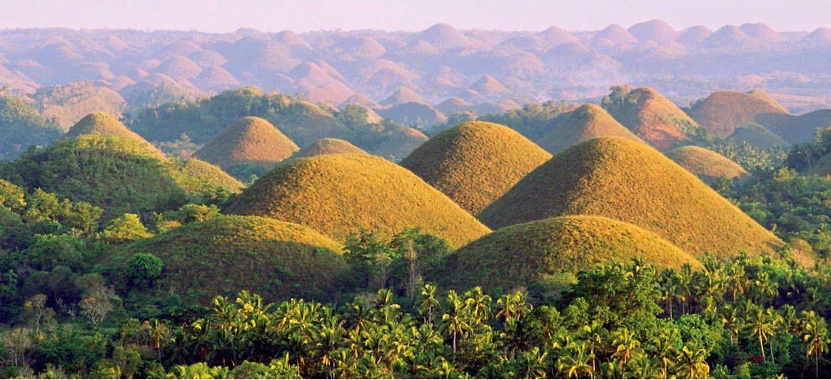
Climb 222 steps to the observation deck at Carmen for the signature panorama of 1,200+ conical mounds. Arrive before mid-afternoon heat peaks.
Drive through the dense mahogany corridor planted in the 1960s. Most vehicles stop briefly for photos along the shaded two-kilometer stretch.
Final stop if time permits; handlers allow butterflies to land on visitors during the 20-minute walk-through. Skip if running late to avoid rush-hour return traffic.
The Bohol Countryside Tour primarily navigates through the interior roads of the island, starting from either Tagbilaran City or Panglao Island. Most visitors access these sites by traveling via the Bohol Circumferential Road.
Private hire via Bohol Circumferential Road
Public transport from Dao Integrated Bus Terminal
Private vehicle hire from Panglao
Private car hire is the standard method for following the countryside map as it allows for direct transit between dispersed locations. Ensure your driver follows the main arterial roads to minimize travel time between stops.
The best arrival window for your Bohol countryside tour is 08:00–09:30 to avoid mid-morning heat and peak crowds from tour buses. Arriving during this period ensures a more manageable experience at major landmarks before the midday influx.
Warm and dry; 25°C to 32°C. This period offers the clearest views but requires early starts to avoid the heaviest tourist flow.
Humid with periodic rain; 24°C to 31°C. Expect shorter queues at major sites, though weather can be unpredictable.
—
Visiting between Monday and Friday allows for quieter viewing conditions compared to weekends. Early arrival within the recommended window is effective for minimizing congestion.
Verdict: Plan your visit for a weekday between 08:00–09:30 during the months of April or October for the best balance of manageable crowds and favorable weather.
The primary sites featured on the Bohol countryside tour map operate on a consistent daily schedule. These hours apply to the main observation areas, including the Chocolate Hills Complex.
The Chocolate Hills Complex is centrally located among several significant landmarks that define the traditional Bohol countryside route. These sites allow visitors to explore historical architecture and local wildlife within the same geographic corridor.
45 min drive
Located in Corella, this sanctuary provides a controlled environment to observe the Philippine Tarsier in its natural habitat.
60 min drive
As one of the oldest stone churches in the Philippines, this site offers a contrast to the natural landscapes of the interior.
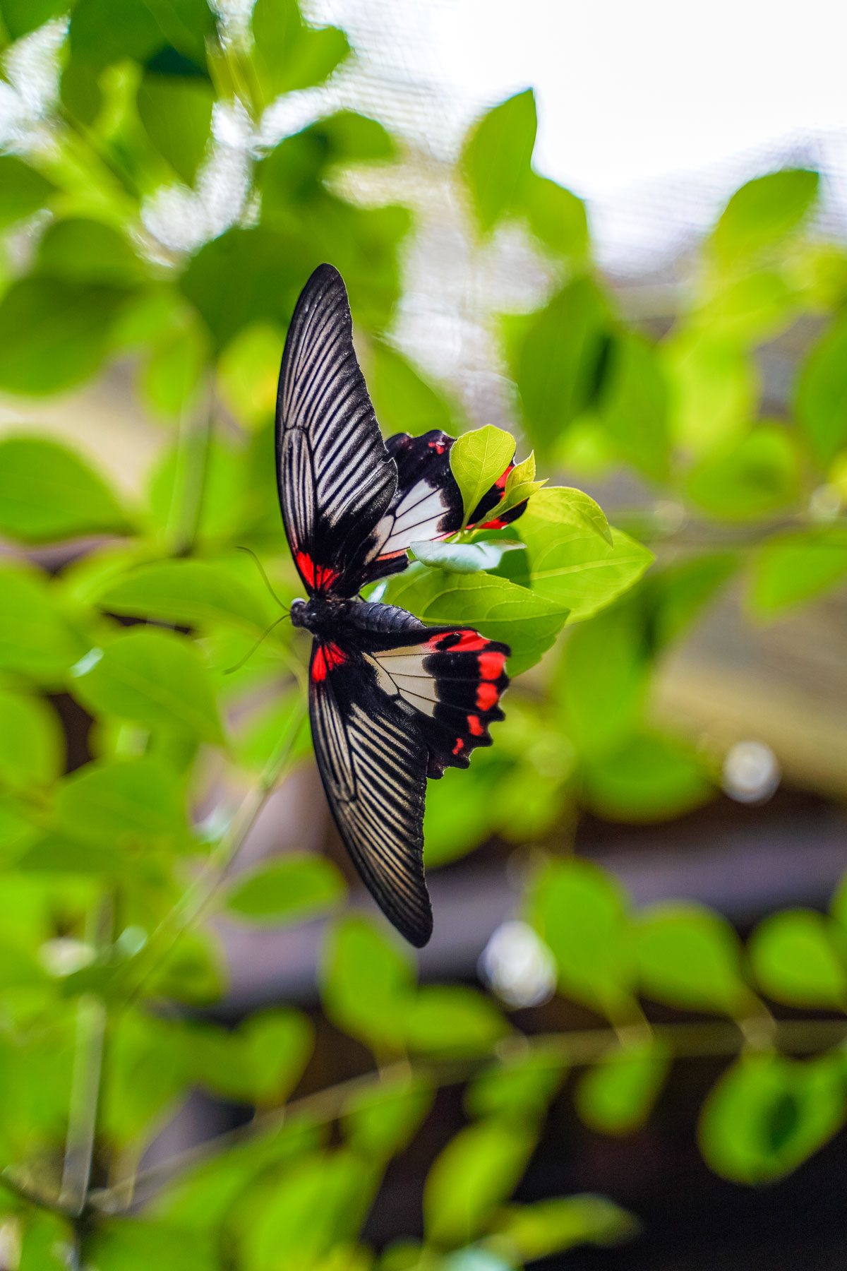
30 min drive
This facility focuses on butterfly conservation and native plant species, providing a quiet stop between larger attractions.
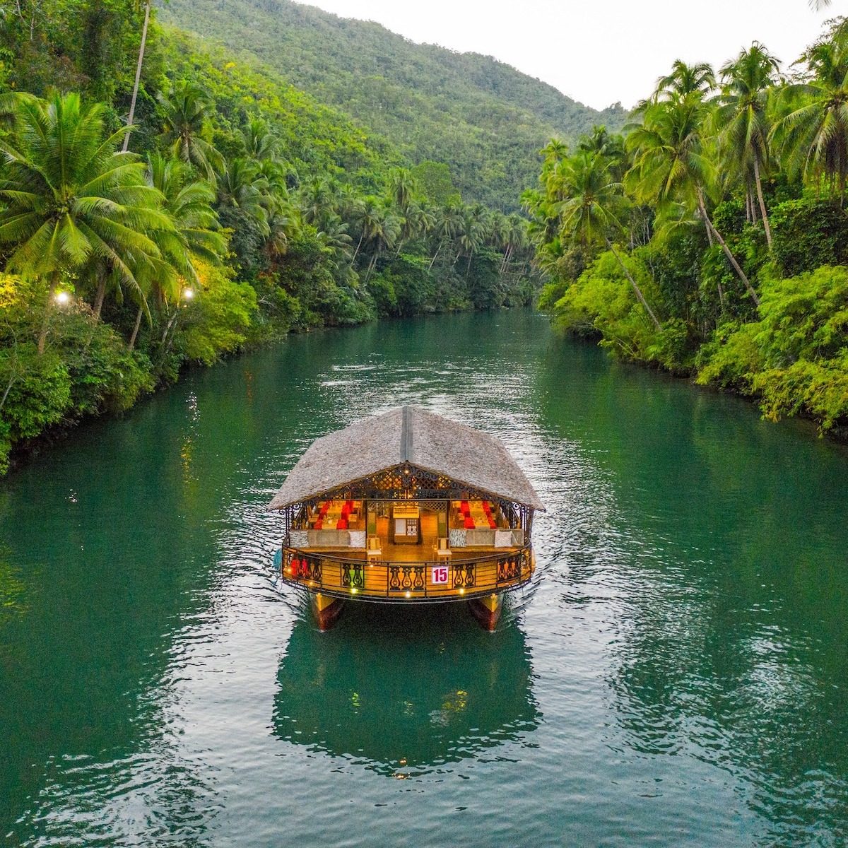
30 min drive
The river winds through the countryside and serves as a natural transition point for those traveling between the hills and the southern coast.
Everything you need to know about bohol countryside tour map
A complete bohol countryside tour map should highlight key geological formations, historical churches, and wildlife sanctuaries across the province. It serves as a visual guide to ensure you do not miss major sites like the Tarsier Sanctuary or the Loboc River.
Using a Bohol landmarks itinerary allows you to group geographically close attractions together to minimize travel time. Organizing your stops logically prevents backtracking and makes for a more efficient day trip.
While you can navigate independently, a guide provides local context and manages transport logistics between stops. A structured Bohol sightseeing route often includes a driver to navigate the winding roads of the interior.
The best arrival window for your bohol countryside tour map is between 08:00 and 09:30 to avoid mid-morning heat and peak crowds. Arriving early ensures you experience the viewing deck with fewer visitors.
Yes, the Chocolate Hills viewing deck requires climbing 222 steps to reach the top. Visitors should wear comfortable footwear and bring water for the ascent.
Having a bohol countryside tour map simplifies your logistical planning by identifying clear paths between rural locations. It helps visitors manage their time effectively when visiting multiple dispersed attractions in a single day.
Yes, most visitors can comfortably visit several landmarks in one day when following an organized bohol countryside tour map. Planning your sequence helps manage the total time spent at each conservation site or historical point.
Is Bohol Worth Visiting?
Read more GuideTop Tourist Spots in Bohol
Read more GuideBohol Countryside Tour DIY Guide
Read more GuideBohol Countryside Tour Rates and Fees
Read more Tickets & toursCountryside Tour from Cebu
Read more Tickets & toursCountryside Tour from Panglao
Read more GuideItinerary and Entrance Fees
Read more